Huntsville sits on a geotechnical puzzle. The limestone bedrock of the Highland Rim weathers into stiff red clay with chert fragments, but just a few miles south the alluvial soils of the Tennessee River valley tell a completely different story. Contractors grading a pad in Cummings Research Park need a different compaction approach than crews backfilling a utility trench near Ditto Landing. The sand cone field density test gives us a direct, reliable number for in-place density without the calibration drift that nuclear gauges suffer in these iron-rich residual soils. For site superintendents who need passes on the first lift, the method is straightforward: excavate, weigh, measure, and compare against the Proctor maximum. No radiation source, no license paperwork, no shutdowns when the gauge acts up in humid weather. We run the test per ASTM D1556, which is the standard specified in most IBC-referenced earthwork specs across Madison County, and we deliver the dry density and relative compaction percentage while the compactor is still on the lift. When the clay is borderline on moisture—and in August here it almost always is—combining the sand cone with a Proctor curve from our lab lets us tell the grading foreman exactly how many passes to add before the sun bakes the water out.
Compaction is the cheapest strength you can buy on a grading job—a point of relative density costs less than re-excavating a failed lift.
Process and scope
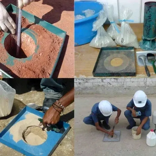
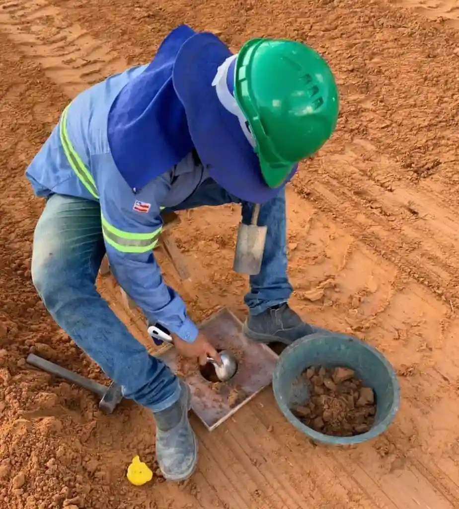
We see a recurring pattern on Huntsville job sites: the top foot of subgrade dries out fast in July, but below 18 inches the moisture holds steady at 2-3 percent above optimum. A nuke gauge reading taken at 12 inches averages those two zones and gives a number that looks acceptable when the bottom lift is actually spongy. The sand cone test avoids that averaging error because you dig exactly to the lift thickness you want to check—six inches, eight inches, twelve, whatever the spec calls for. The procedure is manual but precise: we excavate a circular hole through the full lift, capture every gram of removed soil on a tray, seal it immediately in a moisture can, then pour Ottawa sand through the cone apparatus to measure hole volume. Field moisture and wet density are calculated on the spot, and the relative compaction percentage is reported within fifteen minutes of finishing the hole. For fill soils with chert gravel up to three-quarter-inch size, the standard six-inch-diameter cone plate works fine; for clean sand borrow from the river, we switch to the twelve-inch plate per ASTM D1556 Appendix. The equipment gets calibrated weekly against a density standard in the lab, and we run a sand-cone calibration check on-site before the first test hole of the day. Builders in the Limestone County corridor appreciate that the report format matches what Huntsville city inspectors expect: test location on a site plan sketch, lift number, field dry density, lab maximum dry density, percent compaction, and a pass-fail callout against the project specification.