GEOTECHNICAL ENGINEERING
HUNTSVILLE
HomeUnderground ExcavationsGeotechnical excavation monitoring

Geotechnical Excavation Monitoring for Huntsville’s Challenging Karst Terrain

Geotechnical engineering with regional judgment.

LEARN MORE

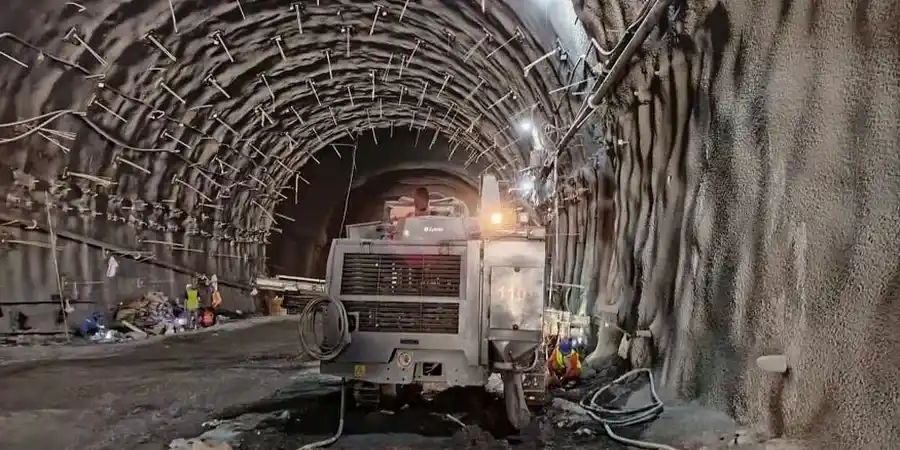
Huntsville went from sleepy cotton town to rocket city practically overnight when the Army brought von Braun’s team to Redstone Arsenal in 1950. That rapid expansion didn’t just reshape the economy—it pushed construction onto limestone terrain riddled with solution cavities and unpredictable overburden. Ask any contractor who has excavated near Big Spring or dug a basement in the medical district: the ground here keeps secrets. The Tuscumbia Limestone under much of Madison County can carry solid bearing one meter and open into a wet void the next. Our excavation monitoring program grew out of exactly these conditions. We install automated inclinometers, settlement points, and crack gauges, then stream data to a dashboard that updates every six hours—faster if thresholds trip. For deep cuts on constrained urban sites, we often pair monitoring with a CPT investigation to confirm refusal depth before shoring design, and a slope stability analysis where the cut face stays open for weeks.

In karst limestone, the ground doesn’t give you a warning—it just goes. Monitoring turns that sudden collapse into a trend line you can act on.
Our service areas

Process and scope

Downtown Huntsville sits on a thin veneer of silty clay—typically two to six feet—over heavily weathered limestone. The water table fluctuates with the Tennessee River backwaters and seasonal rainfall, sometimes saturating the clay contact and triggering lateral movement in unsupported cuts. In the Hampton Cove area east of Monte Sano, residual soils derived from the Fort Payne Chert can behave like gravel with fines, draining fast but raveling badly when cut steeper than 1H:1V. Our monitoring setups adapt to these contrasts: wireless tiltmeters on the shoring every 15 feet vertically, optical survey prisms on adjacent structures, and vibrating-wire piezometers behind the wall to catch pore pressure spikes. When a project near the Von Braun Center required a 28-foot excavation within eight feet of a 1920s masonry building, we combined real-time deformation readings with a deep excavation support plan that included soldier piles and pre-stressed tiebacks—no settlement exceeded 3 millimeters during the entire three-month open-cut phase.
Geotechnical Excavation Monitoring for Huntsville’s Challenging Karst Terrain
Technical reference — Huntsville

Local geotechnical context

The difference between excavating in Research Park versus Five Points tells you everything about Huntsville’s subsurface risk. Research Park, built on relatively intact Tuscumbia Limestone with shallow clay cover, usually behaves well—steady inclinometer readings, minimal vibration impact. Five Points, with its century-old infrastructure and deeper, wetter residual soils over pinnacled rock, is a different animal. We instrumented a sewer interceptor replacement there in 2023 where the trench passed within four feet of three historic bungalows. The contractor expected minor movement; our automated system flagged a 9-millimeter lateral drift on day six, traced to a leaking storm drain nobody knew existed. They shifted the dewatering plan and added a row of helical anchors within 48 hours. Without monitoring, that drift would have become a wall crack—then a claim. Around Redstone Arsenal, where vibration from blasting or heavy compaction can trigger cavity collapse, we deploy triaxial geophones and correlate peak particle velocity with pre-excavation MASW surveys to map void risk zones before the first bucket hits soil.

Need a geotechnical assessment?

Reply within 24h.

Email: contact@geotechnical-engineering1.org

Visual overview

Reference standards

ASCE 7-22 Minimum Design Loads and Associated Criteria for Buildings and Other Structures, IBC 2021 Section 3306 Protection of Excavations, ASTM D1586 Standard Test Method for Standard Penetration Test (SPT) and Split-Barrel Sampling of Soils, ASTM D2487 Standard Practice for Classification of Soils for Engineering Purposes (Unified Soil Classification System), OSHA 29 CFR 1926 Subpart P – Excavations

Technical data

ParameterTypical value
Inclinometer accuracy±0.25 mm/m per reading interval
Settlement point resolution0.1 mm with digital level loop closure ≤1 mm
Crack gauge sensitivity0.01 mm, full-scale 50 mm, IP68 rated
Piezometer range0–100 psi vibrating-wire, 0.025% FS accuracy
Data transmission frequencyEvery 6 hours standard; 15-minute intervals on trigger
Tiltmeter range±15° biaxial MEMS, 0.001° resolution
Compliant withIBC Section 3306, ASCE 7-22, OSHA 1926 Subpart P

Questions and answers

At what excavation depth does Huntsville code require a monitoring plan?

IBC Section 3306 triggers a site monitoring program whenever an excavation extends below the level of an adjacent foundation and the cut is within a horizontal distance equal to the depth of the excavation. In practice, for Huntsville’s urban lots—where buildings often sit right on the property line—almost any cut deeper than 5 feet next to an existing structure warrants instrumentation. We typically recommend at least settlement points and crack gauges on the neighbor’s side, with inclinometers added once the cut exceeds 12 feet.

How much does geotechnical excavation monitoring cost for a typical Huntsville project?

Monitoring programs in the Huntsville area generally range from US$790 for a short-duration setup with basic settlement points and manual readings, up to US$2,780 for a fully automated system with inclinometers, piezometers, crack gauges, and daily reporting over a multi-month excavation. The final cost depends on cut depth, number of adjacent structures, required reporting frequency, and whether we’re dealing with karst features that need extra instrumentation density.

Can you monitor an excavation that’s already underway and showing movement?

Yes—we’ve been called in mid-project more than once. The first step is a rapid deployment of survey prisms and manual crack gauges to establish a baseline within 24 hours. If movement is already visible, we set tight thresholds and increase reading frequency to hourly. From there we layer in permanent instrumentation like in-place inclinometers and piezometers as the situation dictates. The key is getting data flowing immediately so the contractor can adjust shoring, dewatering, or sequencing before the problem escalates.

Location and service area

We serve projects in Huntsville and surrounding areas.

View larger map